
Samaria Gorge Iron Gates: location and visiting context
Locate the Samaria Gorge Iron Gates within the full crossing or a southern visit, and check entrances, walking limits and the onward return.
Last updated October 2026
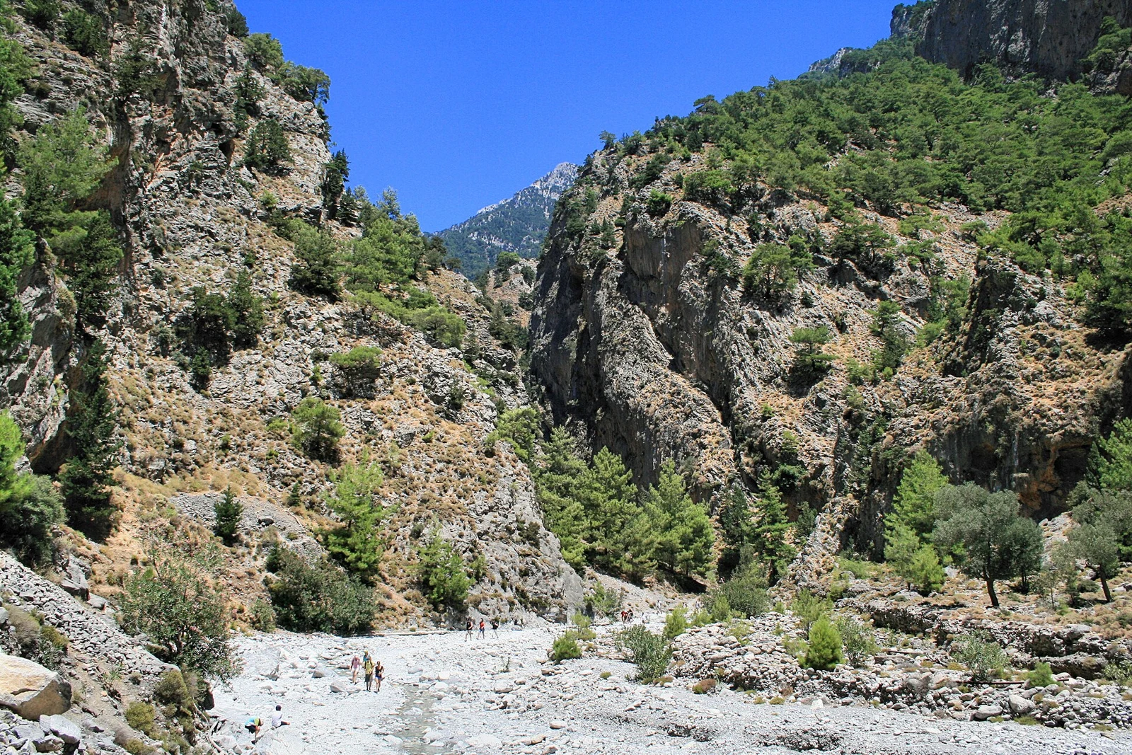
Photo: Lapplaender, CC BY-SA 3.0 de. Resized and converted to WebP.

Contents10
- What the Samaria Gorge Iron Gates are
- Where Portes sits on the walk
- The full crossing: a late feature in a longer day
- The southern approach from Agia Roumeli
- Compare the two ways to reach the lower gorge
- Access and conditions come before the photograph
- Reading the walls without overclaiming
- Choose the walking extent before the travel
- Practical questions about Portes
- Verdict on the Samaria Gorge Iron Gates
The Samaria Gorge Iron Gates are the narrow rock passages called Portes in the lower gorge. They are part of the walking route, not a gate you can drive up to or a separate attraction with its own admission. Reaching them depends on permission to enter the park and the route you choose.
A full north-to-south walk reaches the Portes area late in the crossing. A southern out-and-back visit approaches from Agia Roumeli and returns the same way. These are different walking and transport plans. Both depend on the current entrance notice. A photograph of the narrow walls gives no proof that either approach is allowed today.
What the Samaria Gorge Iron Gates are
Visit Greece identifies Portes, also called the Iron Gates, as narrow passages of the gorge. The name can suggest a built gate in English, but the feature visitors want is the close rock walls. Do not look for a separate visitor centre or a road entrance with that name.
You may see “Doors”, “Iron Doors” or “Portes” in English descriptions. They refer to this lower-gorge feature, not a second gorge. Keep the name attached to Samaria when saving a map or photograph, since other places also use the phrase Iron Gates.
Published descriptions differ on the precise width and wall height. A number can refer to a particular pinch point rather than every passage. We omit a single headline measurement here rather than imply that several descriptions use identical endpoints. The useful fact for a day plan is where this feature sits on the permitted route.
The Ephorate's park guide places Portes near the Agia Roumeli forest outpost. Its route account distinguishes the forest and village farther north from the stony lower channel. That helps you place the gates within the whole crossing.
Where Portes sits on the walk
For a normal north-to-south plan, the broad order is Xyloskalo, the upper path, Samaria village, the lower gorge and the southern exit. You then continue towards Agia Roumeli and the sea. This is orientation only. It is not a scaled map or an instruction to enter during a closure.
Seeing the gates is therefore not the end of the full day. You still need to reach the exit, continue to your coastal destination and find the correct boat boarding point. A walking time quoted only to Portes leaves out those later tasks.
Keep three places separate: the rock passages, the controlled park exit and the village by the coast. A map pin labelled Agia Roumeli can refer to the settlement rather than the entrance. The distinction matters if you are working backwards from a ferry departure.
Save a route description that names those points in order. If a travel product says it visits the southern gorge, ask where the walking part begins and ends. A coast stop in Agia Roumeli does not itself include the gates.
Likewise, a boat passing the village does not provide a view inside the rock passages. The walking element must be stated, permitted and workable within the time ashore. This is worth checking before comparing two trips that both use the Samaria name.
If you set out from the north, you cannot rely on a car being near the gates. Your car or outward bus belongs to the mountain end of the plan. A return from the coast needs separate arrangements, even though the path itself generally leads downhill.
The full crossing: a late feature in a longer day
The full walk suits a visitor who wants the changing route, rather than only a view of the narrow walls. It includes the upper descent and the former village before the lower gorge. That broader experience brings a longer commitment on foot and a finish away from the start.
Do not save all your time and water for the famous photograph. A long day can become hard before the narrowest part appears. Keep a pace that works for your party and the permitted exit arrangements, rather than trying to match another hiker's fastest time.
When comparing a full crossing with a southern visit, ask what you actually want to see. If it is the forest-to-sea route, a short coastal approach will not replace it. If it is the lower passages, you may not need the full crossing, but you still need access and enough time for an out-and-back walk.
The park overview in Visit Greece stresses suitable footwear and fitness despite the downhill route. That applies to the whole walking task. A steep descent and repeated steps on loose ground can be tiring in a way that a flat town walk is not.
The southern approach from Agia Roumeli
A southern visit starts from the coastal side and returns there. It avoids the mountain-to-coast crossing, but it adds an uphill approach followed by the same ground in reverse. “Shorter” is a route comparison, not a promise that the surface is easy.
The ferry company ANENDYK describes a southern approach towards the Doors. Treat that as an outline of the visit, then confirm the permitted distance and turnaround with park staff. A carrier's tourism page is not the authority for today's trail restrictions.
Check the time you can enter from the south, how far you may go and when you must return. These can matter as much as total distance. If your boat arrives late, a route that works for an early arrival may no longer fit.
Do not carry a walking time from one endpoint to another. “From Agia Roumeli” might mean the shore, a village landmark or the park entrance. Ask which starting point is meant before deciding that you can fit the walk between two sailings.
Questions to settle before a southern walk
- Entrance: Does the official notice allow entry from Agia Roumeli today?
- Extent: How far may visitors walk from that entrance?
- Turnaround: Where will your party turn back, within the allowed area?
- Exit time: When must you be outside the park?
- Boat: Which dated departure fits the return to the coast?
- Stay: What is your plan if the sea leg cannot operate?
Keep the answers together. A boat reservation answers only the boat question. It cannot fill in missing park permission or set the walking limit for you.
Compare the two ways to reach the lower gorge
| Choice | Best for | Trade-off | Return task |
|---|---|---|---|
| Full north-to-south crossing | Seeing the upper route as well as the lower walls | A long walk with an early mountain start | Continue to the sea, then use onward transport |
| Southern out-and-back | Focusing on a permitted portion of the lower gorge | The same ground is walked in both directions | Return to Agia Roumeli before your boat or stay |
| Staying outside the park | A day when entry is closed or the walk does not fit | You will not see the gates from inside | Arrange a village or other permitted activity separately |
Scroll for more →
These are visit types, not bookable offers. No choice in this table confirms a current departure, an admission price or an open entrance. Select the route only after reading the current authority notice.
An escorted excursion can arrange some transfers, but it does not move the rock passages closer to the entrance. Ask whether a guide walks with the group or whether the service provides bus escort and transport coordination. Check the description rather than assuming the word “guided” means continuous help on foot.
Access and conditions come before the photograph
Facts checked: 15 October 2026. The NECCA ticket portal reports closure from both entrances pending inspections and gives no reopening date. This includes a visit from the south. It is not limited to the full crossing from Xyloskalo.
Check again close to travel. A closure notice is a dated statement, and a normal visiting season is only a broad calendar. Neither a sunny forecast nor an excursion listed for sale changes the authority's current instruction.
The former park body's visitor guidance directs walkers to follow rangers and signs, including warnings about falling rocks. Follow current instructions on the ground. A famous narrow passage is not a suitable place to block the route while arranging a long photo session.
Keep your attention on where you place your feet. If you want to photograph the walls, stop only where doing so is permitted and does not obstruct others. Do not climb loose material or leave the path to recreate an online image.
Reading the walls without overclaiming
The narrow view is striking because the sides come close together. It can be hard to judge scale from a photograph with no familiar object in it. A wide-angle photograph can also distort the apparent space. Use photographs to recognise a feature, rather than to calculate its width.
Layers and fractures are visible in parts of the gorge. They belong to a longer geological story involving rock formation, earth movement and erosion. A dark line on one face is not enough to date a fault, identify a fossil or explain when the gates first formed.
The Samaria geological review studies the rock units and processes of the wider area. It is the kind of evidence needed for a formation claim. A visitor's description can remain simpler: narrow passages within the lower gorge, reached only as part of an allowed walk.
Avoid collecting fragments as souvenirs. Leaving stones and plants in place protects the setting other visitors come to see. It also avoids turning a short stop into damage to the park. Take a photograph from an allowed position instead.
Choose the walking extent before the travel
Use the Samaria Gorge hike guide to compare the full crossing with a permitted southern return walk. The Gates are a stage within a route, not a reason to ignore the rest of the walking day.
Need the travel chain arranged?
Choose a service by its actual entrance, walking role and full return, rather than a landmark photograph in the listing.
Practical questions about Portes
Can I drive to the Iron Gates?
The Iron Gates are on the gorge walking route, not beside a road visitor stop. A north-side road arrival leaves you at the mountain approach. A southern visit begins from Agia Roumeli and involves walking into the park when allowed. Neither is a drive-up view of the passages.
Are the gates the same as the southern entrance?
No. The rock passages are a feature within the gorge. The entrance controls access to the park, while Agia Roumeli is the coastal destination beyond it. Keep all three places distinct when checking walking times, booking a boat or deciding where a shorter visit should turn back.
Is the southern visit allowed during a closure?
Only the current official notice can answer that for the entrance concerned. At the check recorded here, NECCA reported both entrances closed. A partial walk from the south does not bypass that instruction. Recheck with the authority rather than relying on a tour or ferry description.
Does a shorter approach avoid rough ground?
A shorter route still uses part of the gorge path. It is not a smooth viewing platform reached from a car park. Wear suitable footwear, check the permitted extent and assess the return walk as well as the outward one. Staff instructions and conditions on the day take priority.
Verdict on the Samaria Gorge Iron Gates
Plan for a walking route, not a standalone photo stop. Decide between a full crossing and an allowed southern return walk, then fit the coastal travel around it. The Samaria Gorge National Park guide puts the Iron Gates back into the whole visit, with the access check before the transport plan.